
Walk a Berkeley County Street by Address
For a street-by-street question, begin with the county's Assessor Property Card Search. It accepts a street number and street name, along with TMS, owner, and mobile-home routes. The county advises leaving off the street type, so a road searched as Oakley Road is entered as Oakley. A result is an assessment and ownership record, not proof that a named owner occupies the physical parcel. Keep the physical address, owner field, TMS, and any legal-description detail together before moving on.
The next check is spatial. Search the same address or road in GIS Advanced Mapping, click the matching parcel, and compare its boundaries and assessment link with the property-card result. Only then should a land-record search begin. That sequence avoids joining a common owner name to the wrong lot or an adjacent parcel.
- Enter the street number and name in the county property-card search, then preserve the TMS and site address returned for the matching parcel.
- Search the address or road in GIS Advanced Mapping and click the parcel. Check the boundary, owner and assessment information against the first result.
- Record the legal description, subdivision, lot, block, plat, deed book or page when the parcel record supplies one.
- Use that owner and legal-description trail in the Register of Deeds index, searching party roles and a sensible date range rather than treating a street name as a deed-index field.
- For a dated household clue, use the documented 1956 directory, census material, newspapers, maps, or archives alongside the land trail.
Note: A property owner, mailing contact, or recorded party can connect to an address, but none alone proves every person present there.
Berkeley County Street Property Cards
Real Property Services values about 130,000 parcels and produces property record cards and building sketches. Its direct search has four separate routes. Street searching pairs a number with a name and lets the user choose Contains or Equals. TMS is the county parcel or tax-map identifier. It is often the most stable handoff between the assessor, GIS, a plat, and a deed. Owner-name and mobile-home decal routes can help narrow a known record, but they should not be used to turn a tax roll into a household directory.
| Property-card route | Inputs | Best use |
|---|---|---|
| TMS | One tax-map identifier | Return to a known parcel without depending on street spelling. |
| Street search | Street number, street name, Contains or Equals | Find candidate parcels on a specified road. |
| Owner search | Owner name, usually surname first | Check an owner already tied to a parcel. |
| Mobile-home search | Decal number and owner name | Locate a documented mobile-home property record. |
A property's situs is its physical parcel location. A mailing address is where tax correspondence is sent. Berkeley County processes mailing-address changes, so the mailing field can be a post-office box, business address, representative, or out-of-county contact. Mark it as mailing information, not as an occupancy finding. Assessment data also has its own timing: the county describes ownership and assessment information as generally tied to December 31 of the prior year, subject to stated changes.
Berkeley County GIS Street Controls
Berkeley County GIS Advanced Mapping is the map half of a street directory search. It can search by TMS, owner, address, or street. A parcel click opens ownership and tax-assessment information, while layers can show parcel lines and historic aerials. The Advanced viewer also offers draw, measurement, coordinate, print, and export tools. County data is described as updated nightly, so record the access date when a current result matters.
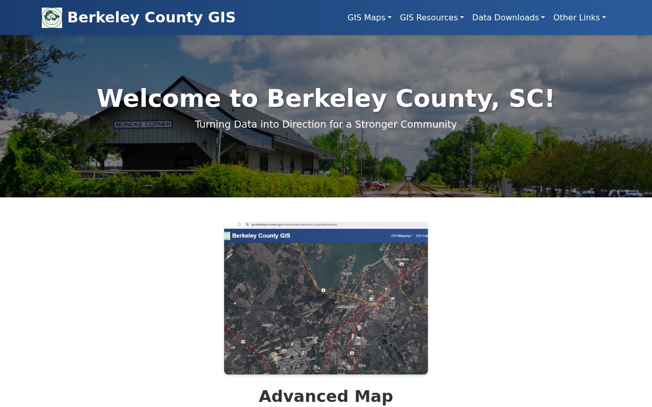
The GIS screenshot shows why a street search should be narrowed to a clicked parcel. The map can make a long road manageable, but a parcel boundary and TMS are stronger identifiers than a street label alone.
| GIS control | What it adds to an address trail |
|---|---|
| TMS search | Finds a known parcel by its tax-map identifier. |
| Owner search | Finds an owner-linked parcel, subject to owner-versus-occupant limits. |
| Address and street search | Finds suggested addresses or street segments before a parcel click. |
| Parcel identify | Connects a mapped parcel with county ownership and assessment information. |
| Layers and aerials | Shows parcel context and dates physical changes without naming occupants. |
Berkeley County Street Records by Address
One address can lead to several different Berkeley County record systems. The records below should be read as a chain, not as interchangeable proof. Start with the property card and GIS parcel to establish the land identifier. Use the deed and plat records to document a transaction or land description. A permit, when a responsible county or municipal office releases it, is evidence of a dated project relationship rather than a complete household account.
| Address-keyed record | Keeper | What it can show | Access path |
|---|---|---|---|
| Property card | Real Property Services | Owner, TMS, site and mailing context, assessment, sketch, and related parcel data. | Public search or office. |
| Parcel map | County GIS | Parcel boundary, mapped address, owner and assessment link, tax lines, and aerial context. | Advanced Mapping or GIS office. |
| Deed or lien index | Register of Deeds | Party roles, recorded date, document type, book/page or file number, and legal-description clues. | Online index, back-scan route, counter, or focused request. |
| Plat or subdivision record | Register of Deeds and GIS | Lot, block, phase, road geometry, restrictions, and land lines. | Plat image or counter record. |
| Permit material | County or municipal custodian | Dated project or named applicant, owner, or contractor where public. | Correct jurisdiction or a focused non-exempt records request. |
Berkeley County has no verified countywide searchable historic permit-result interface. Identify whether the parcel is in an incorporated municipality before asking for a permit record, because a county office does not replace a municipal custodian. The county FOIA portal is the documented submission channel for a non-exempt county record that is not online.
Berkeley County Street Parcels in Numbers
Berkeley County's scale changes the way a street directory should be read. Real Property Services values about 130,000 properties, and the county's reassessment calendar lists 2024 with 2029 next. A map or card may therefore reflect an assessment system with its own update cycle rather than a same-day account of a household. The useful question is narrower: which parcel is this, what ownership or assessment data did the county display, and what recorded document is tied to that parcel?
Historic imagery adds another local layer. GIS lists aerial snapshots for 2023, 2020, 2018, 2014, 2011, 2009, 2006, 2004, and 1995, among other dates. They can help date a road alignment, clearing, structure footprint, or subdivision pattern. They cannot identify a household or establish a move date. Use imagery to test the physical setting, then rely on a dated record for a person or transaction.
Berkeley County Street Deed Records
The Berkeley Real Estate Look Up index is party based. It offers grantor and grantee fields, category selection, date fields, book and page or instrument-number paths, and property-description fields such as subdivision, lot, block, section, map, phase, and unit. A grantor transfers an interest. A grantee receives one. For an address trail, search the owner from the parcel in the grantee role, inspect the deed's legal description, and identify the seller as a candidate earlier owner only after the same parcel description matches.
The ordinary online index and images for all record types begin July 1, 1983. A selected result can supply a party role, document type, recorded date, book or page, instrument number, and a cross-reference. Those are record facts. They are not a conclusion about who lived at the street address.
Use the official ROD search instructions when a name search is weak or a known book/page needs recovery.
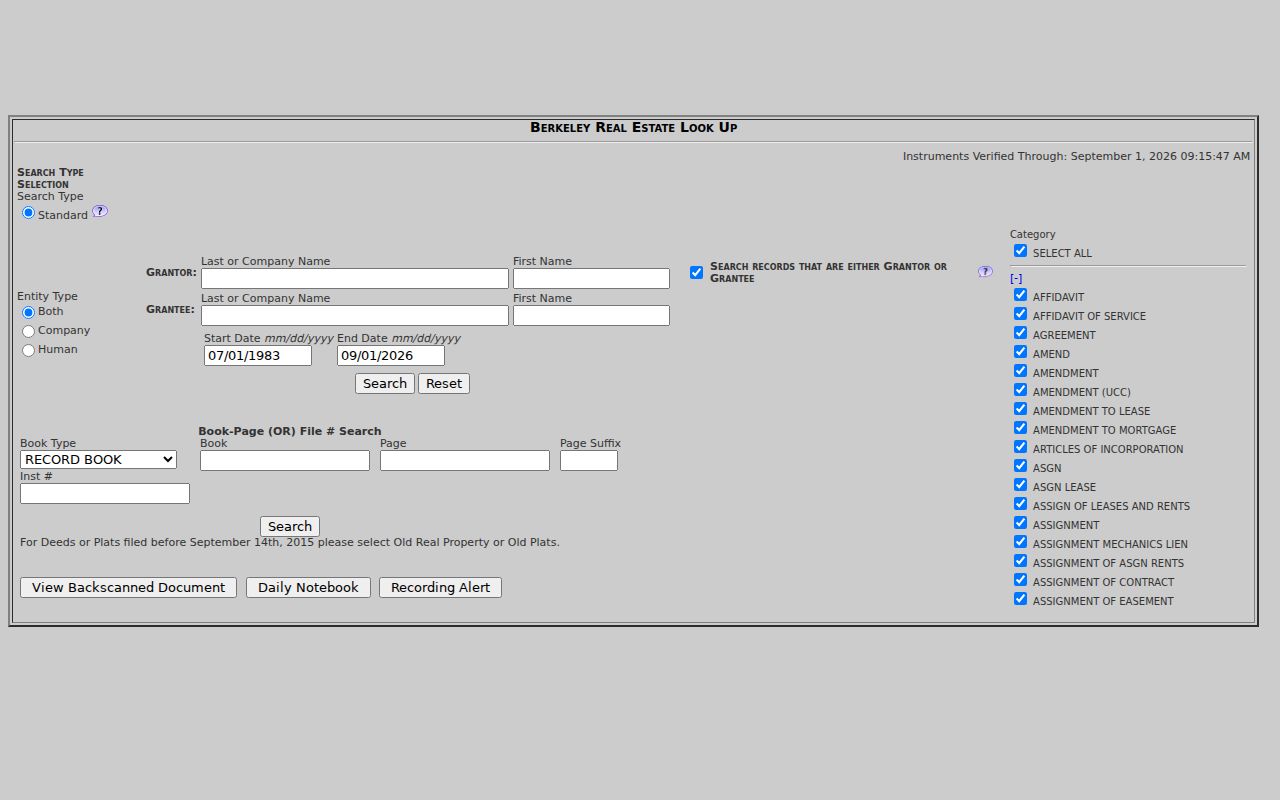
The deed-index form is built around names, date bands, and document identifiers. The parcel's TMS and legal description keep that name search tied to the right land.
Old Berkeley County Street Records
The Register of Deeds has a useful older-record path beyond the ordinary online index. With accurate book and page information, deed and miscellaneous images can be reached from January 1974, and plat images can be reached from 1884. Office land records begin in 1884. The instructions direct researchers to View Back Scanned Document, then Plats or RP, with the appropriate cabinet, book, and page. Older plats may be more legible at the counter.
There is also a date-sensitive selector rule. For deeds and plats filed before September 14, 2015, choose Old Real Property or Old Plats rather than the newer categories. That setting can explain an apparently missing document. The Register of Deeds office can take a focused request by mail, phone, email, or in person when the researcher provides a useful clue such as book/page, owner name, TMS, physical address, or description.
- Parcel
- A defined tract or lot in the county's tax and map system, usually tied to a TMS number.
- Situs address
- The physical location of the parcel, distinct from an owner's mailing address.
- Plat
- A recorded map that can show lots, blocks, phases, boundaries, and street geometry.
- Legal description
- The recorded land locator, such as a lot, block, subdivision, map, or metes-and-bounds description.
Note: A deed search can continue through book, page, plat, and counter routes even after the ordinary online name index stops.
Berkeley County Street Labels and Plats
Street numbers are useful entry points, but older land records may refer instead to a lot, block, subdivision phase, rural community, parish, or road label. A plat can bridge the street name and the legal description. Compare the plat reference shown in parcel data with the deed's land description before deciding two records describe the same address. A subdivision change, master deed, transfer by estate, or altered road label can break a simple name-and-number chain.
The county's GIS FAQ and addressing guidance describes the county's address and map resources, including historic aerial availability. It does not establish a verified countywide historical renumbering event. When an old number does not match, use plats, map geometry, historic road names, and the TMS rather than inventing a conversion.
The county's addressing material is a route to map and address context. It should be paired with the actual parcel and recorded land references for a defensible street match.
A Dated Berkeley County Street Snapshot
For a historical household clue, Berkeley County has one clearly documented local volume: the 1956 Moncks Corner Community Directory. It is a 78-page community directory with a defined scope that includes Moncks Corner, Pinopolis, Bonneau, specified highway areas, and Santee Circle. It is not a continuous annual county directory. Inspect the original page image before assigning an address, occupation, or locality phrase to a particular entry, because catalog transcription can flatten several lines of a page.
The library's South Carolina Room also holds local newspaper microfilm, census material, maps, and local-history collections. Those sources are dated snapshots and corroboration tools, not a current street list. The historical holdings themselves are described more fully in the Berkeley County city directory collection.
Limits of a Berkeley County Street Directory
No public county source examined here is a street-by-street roster of all current households. The assessor and GIS systems connect parcels with ownership and assessment information. The deed index connects recorded parties with land instruments. A voter self-service record is targeted to the registrant and requires county, name, date of birth, and the last four digits of a Social Security number. It is not a public street or block browser. Utility, DMV, confidential court, protected-address, and library-user information are not substitutes for a public address directory.
Lawful use. Berkeley County address records are best used for personal property research, family history, civic questions, or correcting a record. Do not use them to stalk, threaten, harass, impersonate, or bypass a protected address.
South Carolina's Safe at Home Address Confidentiality Program and other statutory restrictions can limit information that would otherwise appear in an ordinary record. Respect that boundary. A missing result may be protected, outside the system's coverage, or keyed to an older land description rather than a current street number.
Check Berkeley County Street Records Carefully
Keep a small record log for each street search: the address used, TMS, map date, parcel identifier, legal description, owner or party role, document type, book/page or instrument number, and access date. That makes it possible to reconcile an assessment field with a deed image instead of turning one field into a claim it cannot support. If the question is about a particular record that is not online, ask the agency that created it or use the county's required FOIA portal for a non-exempt county record.
The Register of Deeds also warns about expensive deed-copy solicitations and says documents from 1983 forward can be obtained through its official route without charge for online copies. Its Recording Alert can notify a monitored name after a recording occurs, but it is notification, not prevention. Verify any record with the office holding it before relying on it.