
Berkeley County Previous Resident Sources
An address history begins with a source-by-era map. A deed identifies a recorded party and transaction. A tax duplicate identifies an assessed name in its own period. A directory or census can supply a household snapshot. A plat supplies land geometry. Probate can explain an estate transfer. These kinds of evidence overlap, but they do not all answer the same question. The most reliable trail preserves the TMS, legal description, lot or subdivision clues while moving backward.
| Address-history source | Years it covers | Where held | What it can show |
|---|---|---|---|
| ROD ordinary online index | July 1, 1983 to present | Berkeley Real Estate Look Up | Indexed deeds and instruments by parties, dates, and types. |
| Back-scanned deed and miscellaneous images | January 1974 to present, with book/page | Register of Deeds online route | Image recovery when an accurate book and page is known. |
| Plats and office land records | Plats from 1884; office land records from 1884 | Register of Deeds online and counter | Parcel plan, lot clues, and an older-record continuation. |
| State Archives conveyance books | 1870 to 1964 | South Carolina Department of Archives and History | Older conveyance sequence, subject to series provenance and access. |
| Auditor tax duplicates | 1884 to 1986 | South Carolina Department of Archives and History | Assessed property and name layer for its recorded period. |
| Moncks Corner Community Directory | 1956 | Library and South Carolina Digital Library | One local community and household snapshot. |
| Probate will books | 1882 to 1956 | South Carolina Department of Archives and History | Estate or heir route, not a direct street-residence record. |
The era table is intentionally not a promise of a continuous list of Berkeley County previous residents. It shows where a record trail may change hands. The current ROD index starts later than some archival records, and the sole documented local community directory is a single 1956 volume. Treat the gaps as gaps, then use the holding institution's catalog, counter, or research room rather than filling them with assumptions.
Start a Berkeley County Address Trail
Begin with the Berkeley County Assessor Property Card Search or GIS Advanced Mapping. The property search accepts TMS, street number and name, owner name, and mobile-home inputs. GIS can search TMS, owner, address, or street. Click the matched parcel and preserve its current site address, TMS, owner field, legal description, subdivision, lot, block, plat, deed-book or deed-page reference when displayed.
These clues serve different purposes. The situs is the physical parcel. The owner mailing address is a tax correspondence address and can differ from the site. The legal description is the recorded land locator, often a lot, block, subdivision, map, or metes-and-bounds description. It can remain useful when an older deed has no modern street number. Property assessment information is not proof of everyone who lived at the address, but its parcel identifiers provide the starting point for a defensible previous-residents trail.
- TMS
- The tax-map or parcel identifier that links county assessment and GIS records.
- Situs
- The physical location of a parcel, separate from a tax correspondence address.
- Legal description
- The land description used in recorded documents to identify the parcel.
- Plat
- A recorded map that can connect lots, blocks, phases, boundaries, and roads.
Follow Berkeley County Deeds Backward
The Berkeley Real Estate Look Up search is organized around parties and document details, not a direct past-address list. It can search grantor or grantee names, document categories, date ranges, book/page or instrument numbers, and property-description components. A grantor is the party transferring an interest. A grantee is the party receiving one. For each prior transaction, match the legal description and plat details against the same parcel before treating the seller as the candidate earlier owner.
- Use the current property card or GIS result to note the TMS, legal description, plat, and displayed deed reference.
- Retrieve the current owner's deed through a book/page path or a grantee search with a reasonable date band and the relevant document type.
- Record the grantor, grantee, recording date, document type, book/page or instrument number, and any earlier-reference language visible on the document.
- Search the prior seller in the grantee role at an earlier date. Recheck the legal description and plat before joining the record to the address.
- Repeat the process, stopping or changing sources when a record points to an estate, a subdivision change, a mortgage event, or a different land description.
A chain of title is the sequence of recorded ownership transfers for the same parcel. It is not a household chronology. A transfer by estate can explain a jump between names, and a deed of distribution or will-book record may be the better next source. When title evidence must be formal, contact the Register of Deeds or a qualified professional; the county office does not perform title searches or give legal advice.
Note: Compare the parcel's legal description on every deed, since a shared surname or matching street number can still point to a different tract.
Berkeley County's Old-Record Switch
The Register of Deeds makes a deeper address history possible when a normal search stops. Its standard online index and images for all record types begin July 1, 1983. Accurate book/page information can reach deed and miscellaneous images from January 1974 and plat images from 1884. The office describes a View Back Scanned Document route, followed by Plats or RP and the matching cabinet, book, and page. Older plats may be clearer at the counter.
For deeds and plats filed before September 14, 2015, the ROD directs users to select Old Real Property or Old Plats rather than a newer category. This is a documented portal behavior, not a new historical era. When the index does not continue, preserve the last book/page, contact the ROD with that clue, and move to the office or the State Archives record series as appropriate.
Archive Dates for Berkeley County Addresses
The South Carolina Department of Archives and History Berkeley County guide is the key older-record route. It lists conveyance books from 1870 to 1964, plat books from 1885 to 1958, real-estate mortgage books from 1880 to 1969, voter-registration books from 1883 to 1956, auditor tax duplicates from 1884 to 1986, probate will books from 1882 to 1956, and administration bonds beginning in 1883. These are strongly dated sources for a Berkeley County address project, but each needs to be used for its own purpose.
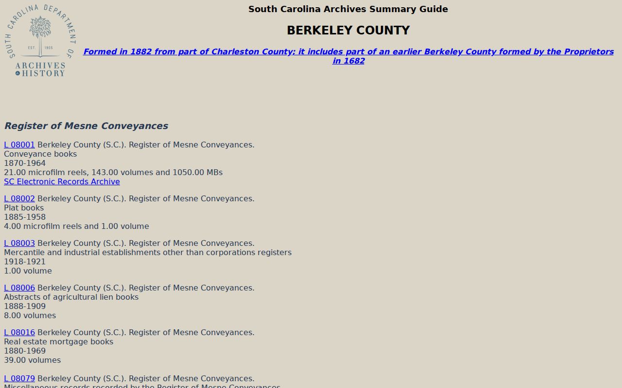
The archives guide is a finding aid to record groups, dates, and formats. It helps locate an older series when an online deed search has reached its boundary; it does not make every volume a current-address record.
Berkeley County was formed in 1882 from part of Charleston County. The guide also contains some earlier series because territory and records provenance can be complicated. For an event before the present county's formation, verify whether Charleston, parish, or state custody is the better route. The county seat moved to Moncks Corner in 1895, so older citations can also point to Mount Pleasant instead of the modern county-seat location.
1956 Berkeley County Household Snapshot
The 1956 Moncks Corner Community Directory is the documented directory source for a previous-residents search. The 78-page object was digitized by the Berkeley County Library System and is available through USC Digital Collections. It covers Moncks Corner, Pinopolis, Bonneau, defined highway areas within five miles of Moncks Corner, Highway 52 North to Bonneau, and Santee Circle. It is broader than one town, but it is not a countywide or continuous annual directory.
A page transcription can contain names, initials, titles, locality words, street labels, and occupation terms. Check the original scan before assigning a page-level word or address to an individual household. The correct reading process is modest: locate the surname or initials, verify the household grouping and locality in the image, then test the finding against a newspaper, census record, deed, tax duplicate, or map of the same period.
For the holdings and access routes behind the volume, see the Berkeley County city directory collections. The South Carolina Room is reference-only for many unique materials, and its catalog is the authority for the specific local-newspaper microfilm issues and volumes available.
Map a Berkeley County Past Address
Historic maps bridge the point where a current number is no longer the right key. The South Carolina Room lists quadrangles for places including Bethera, Bonneau, Cordesville, Eutawville, Honey Hill, Huger, Jamestown, Moncks Corner, Mt. Holly, Shulerville, and Summerville NW from 1927 to 1972. Parish maps, Santee Cooper project material, and community histories can help decode rural locality names. GIS historic aerials extend as far back as 1938 and include later dated imagery. They can show a road alignment, structure footprint, clearing, or subdivision pattern, but cannot name occupants.
A practical household flow is: current parcel and legal description, then deed or plat, then an era-matched tax duplicate or archival conveyance, then a directory or census snapshot, then newspaper or probate corroboration. Federal census material in the South Carolina Room is a snapshot at enumeration, and later releases follow the federal 72-year rule. Do not force a modern street number into a historic map when the plat, rural road, parish, or locality clue says otherwise.
Note: No official countywide historical renumbering decree was verified, so use maps and land descriptions instead of assuming a number conversion.
Limits on Berkeley County Previous Residents
Land, tax, probate, directory, census, and map records each have limits. Recorded parties and assessed owners can be traced more consistently than everyone who may have stayed at a place. A directory or census is dated evidence, not proof of a later or current address. A missing name can mean the place was outside the source's scope, the record used another locality or land description, the source has not been digitized, or statutory privacy rules apply.
Lawful use. Berkeley County previous-resident research fits house history, family history, estate questions, and personal curiosity. Do not use a past address trail to stalk, harass, threaten, impersonate, or circumvent a protected address.
South Carolina's protected-address rules and other record restrictions remain in force. Use an official custodian, the library, or the Archives research room for a permitted historical question, and verify a significant fact against the record that actually created it.