
Berkeley County Neighbor Parcel Sources
Berkeley County neighbors are best understood as a set of nearby parcels with different record trails. Advanced GIS supplies the map geometry. The property card supplies assessed-owner and tax-contact context. The Register of Deeds index supplies recorded parties and instruments. None of those sources is a current household list. A parcel may be undeveloped, held by a business or trust, served by a shared drive, or associated with a tax mailing address elsewhere.
| Block source | What it shows about the block | Access route |
|---|---|---|
| GIS Advanced | Parcel lines, address or TMS, map location and owner or assessment link | Free map with click, pan and layer tools |
| Property card | Assessed owner, situs and mailing-field context for one parcel | Public county reference search |
| Recorded instrument | Party role, document type, date, book or page and legal-description clues | Register of Deeds index and copy routes |
| Precinct maps | Electoral geography for an address | County Elections map material |
| Community collection | Dated local history, newspaper, church or directory context | Library reference or digitized item |
Keep “owner,” “mail recipient,” “recorded party,” and “person who lives nearby” as distinct terms. A site address is the physical parcel. A mailing field is where a tax notice goes. A deed identifies its named parties at the recording date. Each can be useful, but they answer different questions about the block.
Note: Click and record each parcel separately, because a visual near-match on a map does not establish a shared boundary.
Berkeley County GIS Neighbor Parcels
The county’s GIS method is specific. Search an address, owner, street or TMS, then zoom close enough for the parcel layer to appear. Select the center parcel and record its TMS or ParcelID, site address, owner or assessment clue, legal or plat values where shown, and map position. Pan one parcel outward, then click each boundary-sharing or nearby polygon one at a time. The map’s tax lines, identify tool, layers, drawing, measure, coordinates and print or export controls help orient the search.
GIS does not document a dedicated public neighbor-buffer tool. It does document parcel clicks, so a careful Berkeley County neighbors search uses individual clicks rather than an invented radius. Map configuration can also show subdivisions, municipal boundaries, zoning and voting geography. Those layers explain place and jurisdiction. They do not establish that a particular person is present at a particular address.
For the initial parcel card, use the Berkeley County Assessor Property Card Search. Its direct routes include TMS, street number and name, owner name, and mobile-home decal or owner. The assessor distinguishes the physical situs from the tax mailing field. The county says Real Property handles property-card and mailing corrections, while GIS handles street and address errors.
Berkeley County Neighbor Parcel Flow
Use one address to build a parcel map, then stop at the record relationship that actually answers the question. The process below keeps the central lot, surrounding lots and any title research from being merged into one unsupported list of neighbors.
- Find the central address or TMS in Advanced GIS and save the visible parcel identifier, legal-description clues and map location.
- Zoom until the tax-boundary layer is clear, then click only boundary-sharing or nearby parcels individually.
- For each parcel, note its own TMS, assessed-owner field and assessment date. Do not copy values from the central parcel to another lot.
- When a history question remains, take that parcel’s deed book, page, legal description or party role to the Register of Deeds.
- Use a recorded plat or subdivision document when a shared road, common area, condominium or lot layout makes the boundary uncertain.
A full named-street record chain has a different scope. The Berkeley County street directory is the appropriate route when the question moves beyond the immediate block to a street-wide sequence of parcel and deed records.
Note: A recorded owner may be a person, organization, trust or estate, and the parcel record does not resolve every relationship to the address.
Berkeley County Neighbor Voting Boundaries
There is no verified official public browser for voter names down a Berkeley County block. MyscVOTES voter information is a targeted login that requires County, First Name, Last Name, Date of Birth and the last four digits of the Social Security number. It is designed for the registered voter’s own registration, sample ballot, polling place and voting-history information. Voting history records participation, never ballot selections.
South Carolina Code § 7-5-170 and current Election Commission procedures govern voter-record access. The separate saleable-data route has its own eligibility and ordering process, and it does not create a public block roster. The county’s Elections office publishes precinct and district material, which can place an address in electoral geography without identifying who votes there.
The official South Carolina voter-list ordering portal shows an order and status path, not a public neighbor browser.
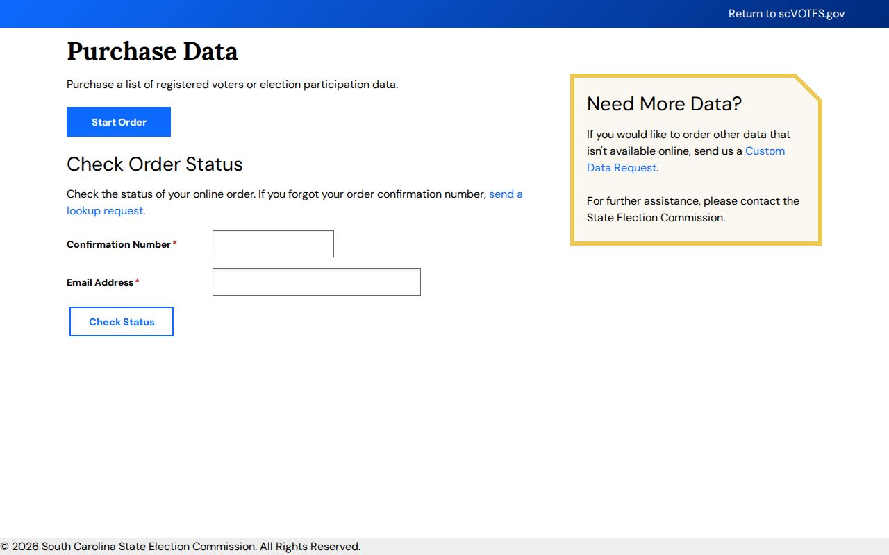
Use a precinct map to understand the boundary serving an address. Do not use voter tools to infer a person’s private activities, ballot choices, or presence at a nearby property.
Berkeley County Neighbor Community Contacts
Community sites can offer a voluntary layer for Berkeley County neighbors, but public contact details are not permission to reproduce a member list. The research found no authoritative countywide association directory. Use a particular association’s own published contacts, covenants, newsletters, meeting material or recorded restrictions, and treat member-only tools as private even if a public page uses the word directory.
| Community layer | Publicly confirmed information | Boundary |
|---|---|---|
| Tall Pines HOA, Ladson | Public contacts, covenants or bylaws, newsletters and facility information | No public resident directory |
| Cooper Estates HOA, Moncks Corner | A site navigation item called Community Directory | Member-controlled unless defined fields are openly published by the association |
| Pimlico Civic Club or Special Tax District | County board, commission and community-administration material | No verified household or member roster |
Tall Pines’ public community page is an example of the limited public contact and covenant material an association may choose to share.
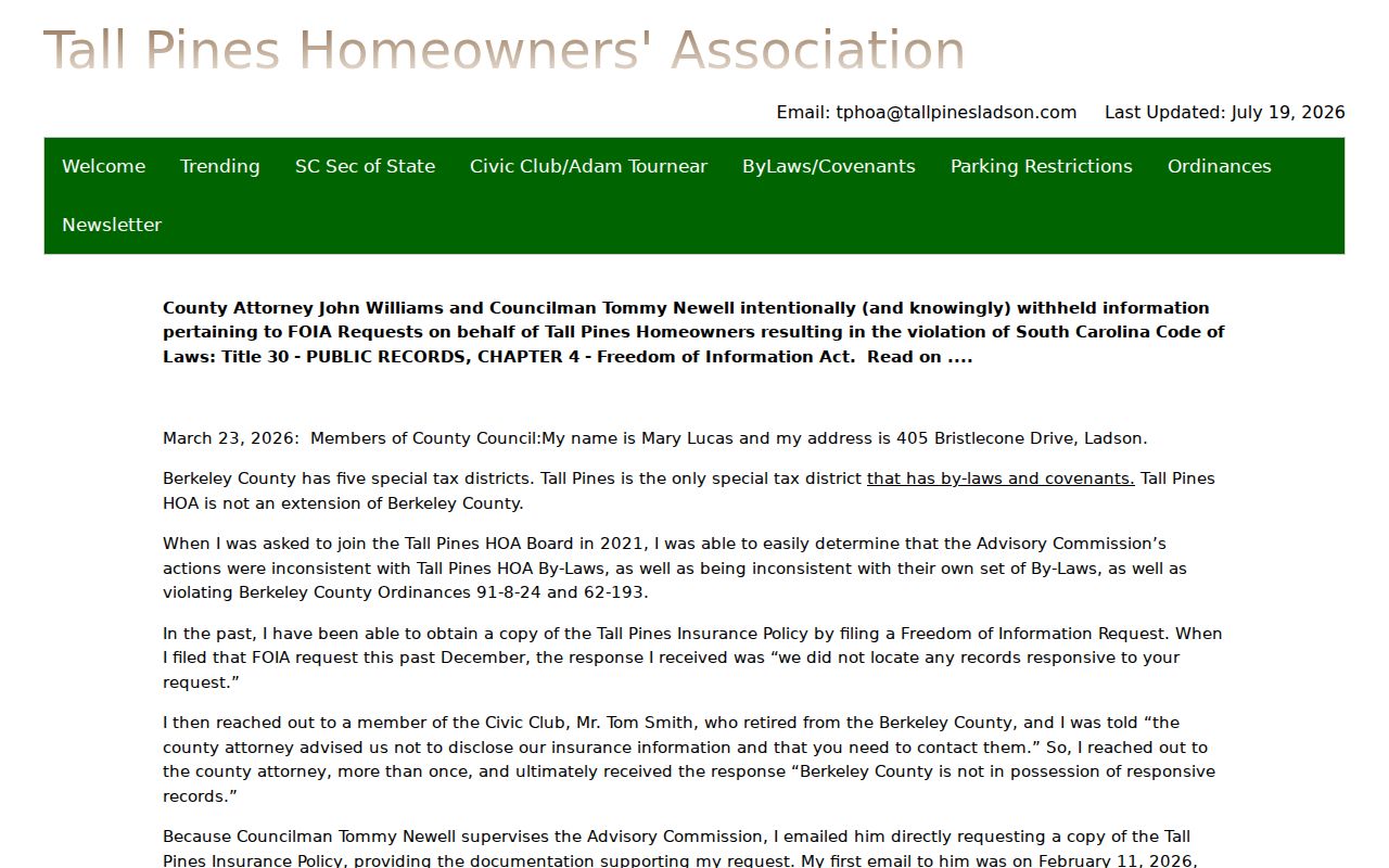
The public Tall Pines material supports a community-information check, not a directory of people. The same restraint applies to a public officer name, a meeting notice or recorded subdivision covenants.
Note: An association contact can answer a governance question, while individual names and private contact details remain controlled by the association and its members.
Berkeley County Neighbor Map Layers
Historic aerials add a useful geography layer to a Berkeley County neighbors question. GIS offers aerial imagery reaching 1938, then 1957, 1963, 1969, 1977, 1989, 1995, 1999, 2004, 2006, 2011, 2014, 2018, 2020 and 2023. Comparing early and later views can show a road alignment, structure footprint, clearing or subdivision pattern. It cannot identify who occupied the land at any date.
The South Carolina Room complements the map with 1927 to 1972 quadrangles, parish maps, local newspapers, church records, the 1956 Moncks Corner Community Directory and oral-history materials. These help when a nearby road or community name changes over time. Keep the title, date and holding institution with every historical reference.
This is a geography finding, not a people finding. Aerials and maps can make a shared-road or parcel-shape question clearer before a plat or deed is read.
Berkeley County Neighbor Address Requests
When an online result is missing, ask for a narrow, dated agency record rather than a list of people around an address. A request about a parcel can name the TMS, address, permit or case number if known, date band, record type and preferred electronic format. GIS requests can name a parcel or a specific map or data product. That gives the custodian a record target and reduces unnecessary personal detail.
| Official record route | Useful for | Limit to preserve |
|---|---|---|
| GIS, assessment or Register of Deeds | Parcel geometry, assessed context and recorded instruments | Each record has its own date and party role |
| County Elections maps | Precinct or district geography | Maps do not identify voters |
| Focused custodian request | A dated public agency record tied to a parcel | Exemptions and redactions still apply |
| General commercial neighbor tools | Unverified compiled hints, if any | Not an official source and not proof of a block relationship |
Berkeley County requires its FOIA portal for county requests rather than email or fax. Under § 30-4-30, the custodian makes the statutory availability determination within 10 business days, or 20 business days for a record more than 24 months old. The county fee schedule should be checked before asking for large maps, scans or staff work.
Berkeley County Neighbor Privacy Limits
Visible parcels do not make all information about Berkeley County neighbors public. A property mailing field may be a tax contact away from the site. Deeds identify recorded parties, not current occupants. GIS imagery shows physical change, not people. Utility, delivery and DMV information are not a fallback source, and protected-address participants remain protected. South Carolina’s Safe at Home program can use a substitute address in defined government-record contexts.
The same limits apply to association material and records with confidential components. Do not assemble scattered clues into a household claim, publish private contact information, or attempt to overcome a protected address. If an official condition, zoning question, district issue or public meeting record is needed, ask the named agency or association for that limited record.
Lawful use. Use Berkeley County neighbors research for personal, community, property or family-history questions. Do not use public records to stalk, harass, threaten, impersonate or bypass a confidentiality program.